

This is a great nine-mile circular route which takes in some fabulous views of the Peak District from its highest point, Kinder Scout (weather dependent of course!). The route takes in William Clough, the Pennine Way, Kinder Downfall, and Kinder Low.
I did this route with some friends a couple of years ago when they were in training for the Yorkshire Three Peaks challenge. It’s a fairly challenging route with lots of uphill but you’ll hopefully be rewarded with the views along the way.
Distance: 9 miles (14km)
Time: 5 hours
Parking: Bowden Bridge car park and there is additional free parking along Kinder Road, if you can find a space.
Facilities: There are public toilets across the road
Map: Map & GPS download here, also try route planning using the Komoot app.

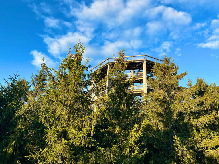
Kinder Scout
Kinder Scout is the highest point in the Peak District National Park, standing at an impressive 2,087 feet above sea level. It’s the site of the 1932 mass trespass where ramblers peacefully protested for access to what was then private land.
It offers some impressive views and on a clear day you’ll be able to see the city of Manchester, as well as all the way over to the Eyri National Park in North Wales. If you have keen eyes, it is technically possible to see Snowdon.
There are many Peak District walks which include the Kinder plateau, including the Edale Skyline, a 20 mile walking challenge.
Preparing for Kinder Scout
The route is rocky in places and the paths can be difficult to see, so always take a navigation app with you, and a paper map as a back up. Be sure to dress correctly for the weather conditions, bringing warm, waterproof clothing with you.
The moorland can be very boggy, especially if it’s been raining recently, so a good pair of hiking boots is recommended. You may also want to pack a spare of walking socks in your backpack.
Route
Starting from the car park, head across the road and follow down to Booth. Cross the river over Booth Bridge and then follow the signpost through a gate on the left.
Follow the path along the river bank until you get to a footbridge and cross over here. Once you reach the entrance to the water works, take the cobbled lane to your left.
As you climb this lane you’ll get to enjoy some stunning views of the reservoir.
Continue on, ignoring the stony track to your left. From here there are a choice of routes which all lead to the top. As you get towards the top you’ll reach some stone steps. Take a right here and climb some stone steps to Kinder Plateau.
Continue along this path and you’ll see Mermaid’s Pool beneath the slopes, perfect for a dip if the weather is good!
Keep going and you’ll reach the boulders which signify Kinder Downfall – an impressive waterfall, especially if it’s been raining. If the weather is windy, you’ll be lucky enough to see the waterfall in inversion, where it blows backwards, which is really quite spectacular.
The summit of Kinder Scout is not marked by a trig point but the Kinder Low trig point is further along the plateau.
From here, follow the flagstone path to the right. Turn right through the gate and you’ll find an ancient marker post in the shape of a cross. Follow the path downhill.
Carry on along the path through fields until you arrive at a tarmac road, bearing right at the fork in the road with the stream on your left and then continue on to your starting point at Bowden Bridge car park.
FAQs
What is the nearest village to Kinder Scout?
You can start your walk up Kinder Scout from Hayfield, like this route, or from Edale in Derbyshire’s High Peak. Edale has a train station so is more easily accessible if you don’t have a car.
Where do you park to do Kinder Scout?
For this route up Kinder Scout from Hayfield, park at the Bowden Bridge car park. If you’d prefer to start your walk in Edale, you can park in the large public car park here.
Be sure to arrive early, especially when the weather is good or at weekends, as this car park soon fills up. Bring cash for the car park.
You can pay online by card, however, there isn’t usually phone signal here. You can head to the nearby cafe to use their Wi-Fi, if you get a drink.
Is Kinder Scout a hard walk?
Most of the routes up to Kinder Scout are challenging, as they are long routes with a lot of uphill, over some boggy terrain. Kinder Scout from Hayfield is a little easier going than some of the other, more scrambly routes.
Is Kinder Scout a hill or a mountain?
Kinder Scout isn’t technically a mountain, although it’s height meets the definition of one. It’s a moorland plateau in the Dark Peak area of the Peak District and it covers around 10 square kilometers.


2 Responses